2014/09/21 09:18 Chile-Bolivia Border Region
| Date (UTC) |
Longitude |
Latitude |
Depth (km) |
Mw |
Analysis |
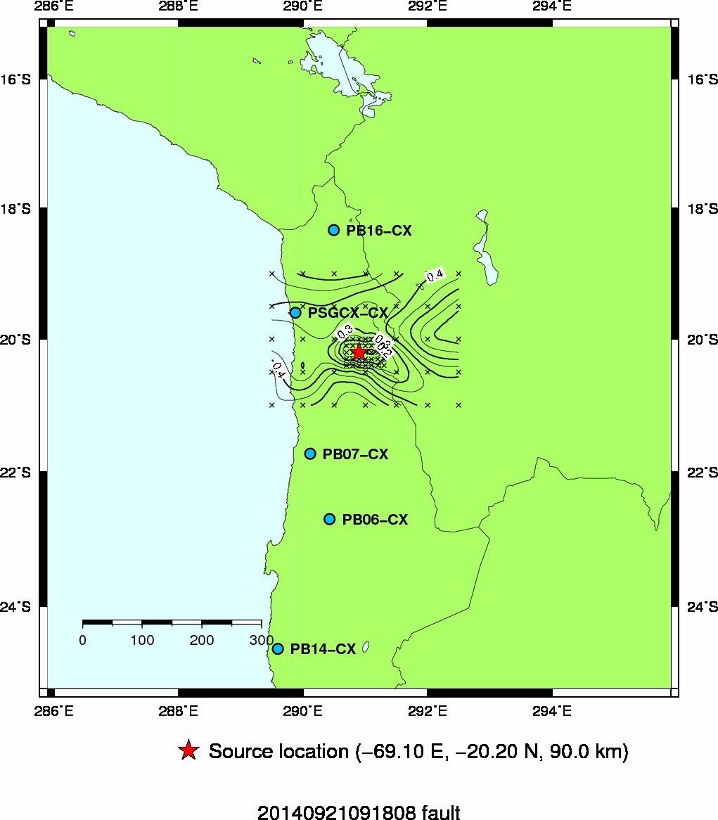
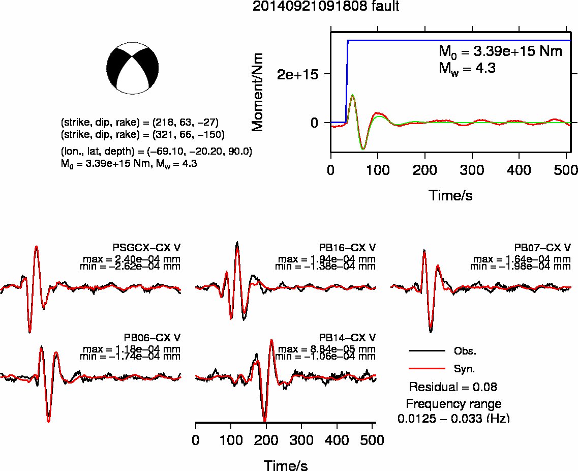
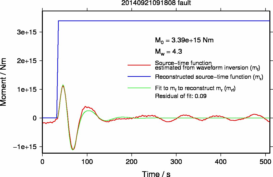
| 2014/09/21 09:18 |
69.1 W |
20.2 S |
90 |
4.3 |
Manual (Rapid solution) |
Grid spacing
- 0.1 degree for the longitude and latitude
- 5 km for the depth
- 1 degree for the dip, strike, and rake
Last update: 2014/09/22 17:35 (JST)
Back to earthquake list
- Map showing the source location and contour of residuals of waveform inversions
- Source mechanism and Waveform fits
- Source-time function
- Previous results
Back to earthquake list