2014/06/22 16:35 North of Halmahera, Indonesia
| Date (UTC) |
Longitude |
Latitude |
Depth (km) |
Mw |
Analysis |
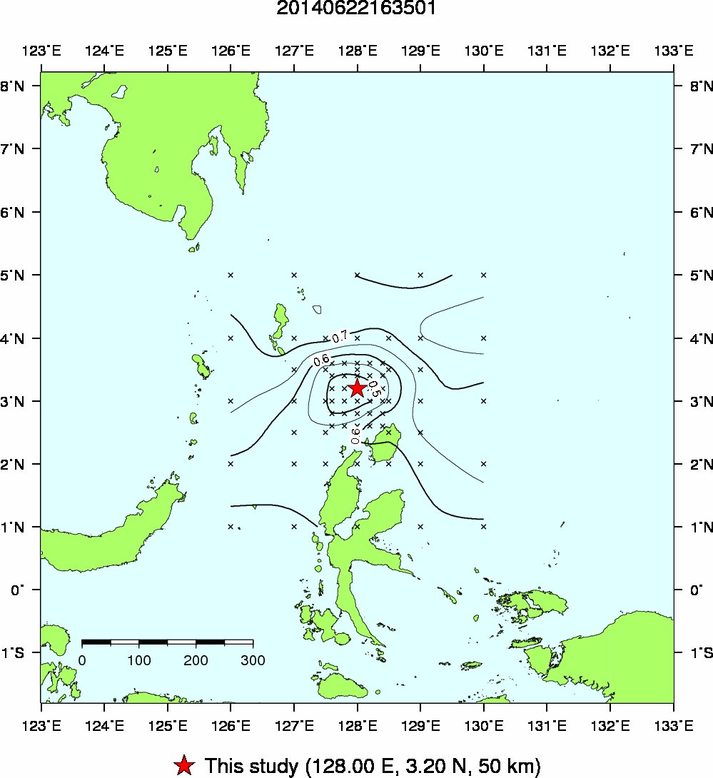
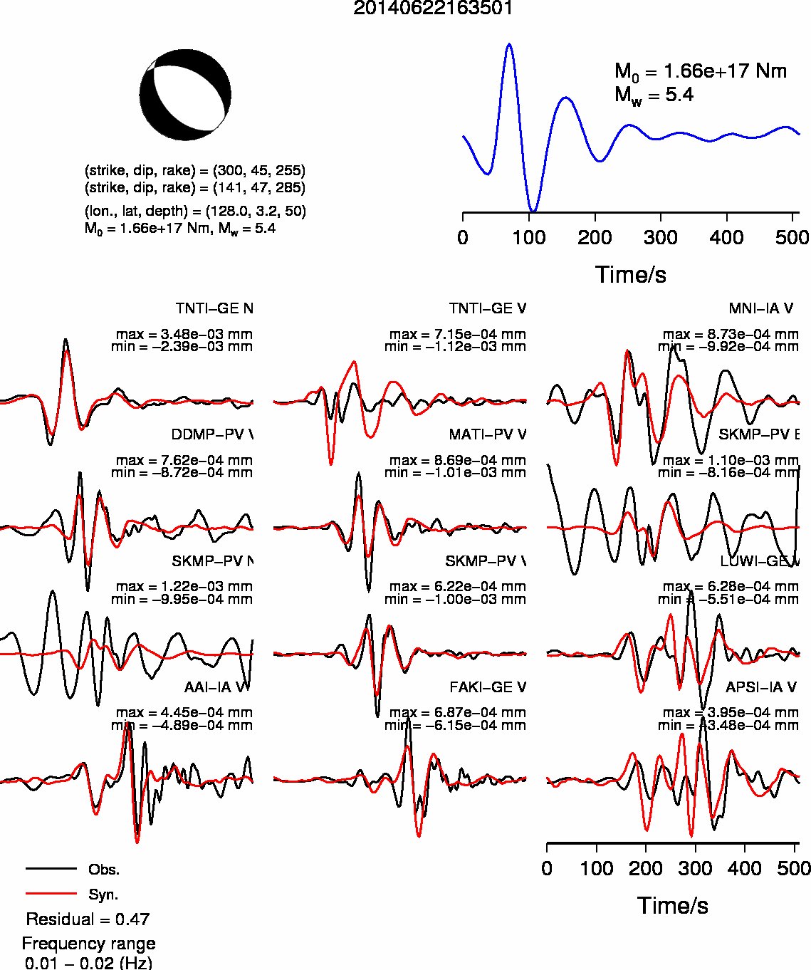
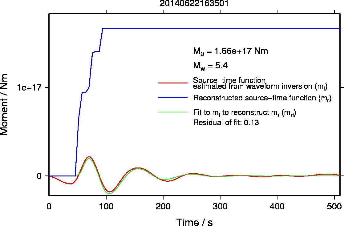
| 2014/06/22 16:35 |
128.0 E |
3.2 N |
50 |
5.4 |
Auto |
Grid spacing
- 0.2 degree for the longitude and latitude
- 5 km for the depth
- 15 degree for the dip, strike, and rake
Last update: 2014/06/23 01:51 (JST)
Back to earthquake list
- Map showing the source location and contour of residuals of waveform inversions
- Source mechanism and Waveform fits
- Source-time function
- Previous results
Back to earthquake list