- 1. Introduction
-
On September 30 2009 at 5:16 (local time), an earthquake with magnitude
(Mw) 7.5 occurred in southern Sumatra, Indonesia. Our waveform analysis
shows that this earthquake ruptured a reverse fault at a depth of 70-80
km. This earthquake caused severe damages in Sumatra.
- 2. Location of this earthquake
-
The Indo-Australia plate is subducting northward beneath the Sumatra
island, which is located on the Eurasia plate (Figs. 2-1, 2-2). Since
the focal mechanism of this earthquake shows that the compression axis
is oriented in NW-SE direction, this event occurred in the subducting
plate, not on the plate boundary.
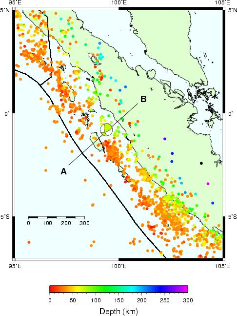
Fig. 2-1. Epicenter distribution obtained from USGS PDE (circles,
between 1973 and 2009). The source centroid location obtained by this
study is shown by the focal mechanism symbol.
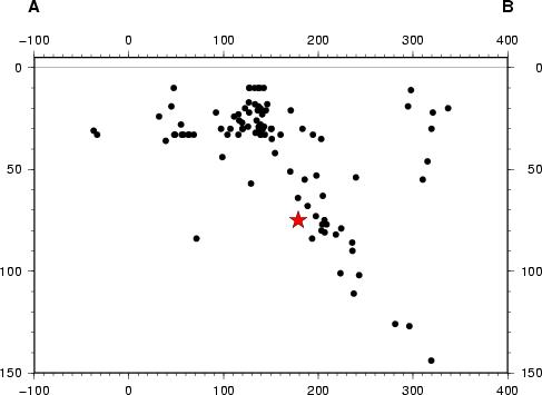
Fig. 2-2. Vertical cross-section of the hypocenter distribution (USGS
PDE) along the profile A-B shown in Fig. 2-1. The star indicates the
source centroid location obtained by this study.
- 3. Rupture duration
-
Our inversion analysis shows that the fault rupture during this
earthquake took about 12 s (Fig. 3). This value is smaller than the
typical duration for earthquakes of this magnitude (about 28 s for
Mw=7.5 events, after Ekstrom and Engdahl, 1989, JGR).
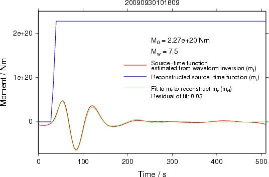
Fig. 3. The estimated moment function (blue line).
Last update: October 1, 2009
NIED HOME International Seismic Network Laboratory, NIED
|